Picture a mountain trail you know well from summer. In winter, snow covers the familiar path, ice makes every step more deliberate and the sun sets hours earlier, leaving less daylight to finish the hike. The views and landmarks you remember can look completely different, and a route that felt simple in summer suddenly takes more thought.
Before you set out, you'll want to recheck the route and weather, estimate how long the hike will take, and prepare offline maps and backup navigation.
This guide walks through planning a winter mountain hike, from choosing a route to checking the weather. We'll also look at how Suunto Vertical 2's maps, navigation, battery and lighting features help at each stage of your adventure.
Table of Contents
Why Winter Mountain Adventures Demand More Planning
Every winter hike starts with a plan and a pace in mind. Out on the trail, though, things shift. Some sections will make you slow down, fading daylight may mean you need to pick up the pace on the way back, and the weather can change your plans entirely. These small surprises are why winter hiking calls for a little more preparation.
Changing Trail Conditions
Winter trails can look very different from what you're used to. Snow can hide trail markers and tracks, making familiar routes harder to recognize, while slippery surfaces, uneven snow and steep slopes slow you down and demand careful footing.
When planning a winter route, look beyond distance. Pay attention to how easy the route is to follow, trail conditions, terrain complexity, slope and total elevation gain.
Shorter Daylight Hours
Shorter days mean less daylight for hiking. A route you could comfortably finish in summer may need an earlier start and a carefully planned return time in winter.
Unpredictable Weather and Cold
Mountain weather can change fast. Snowfall, strong winds or fog can cut visibility, and snow and ice make the trail harder to navigate. In these conditions, you may need to slow down or change your route.
Cold also drains electronic devices faster. On a longer hike, account for the power used by continuous GPS tracking and navigation.

How to Plan Your Winter Mountain Route
Choosing a destination is only the first step. Before you set out, think about how challenging the route will be, how long it may take and what you'll do if the weather changes or something unexpected happens along the way.
Assess Distance, Elevation and Terrain
Start with the route's total distance, elevation gain, slopes and terrain. A shorter route with repeated climbs or tricky terrain can be more demanding than a longer one with gentle slopes.
To get a clearer picture of what's ahead, check the elevation profile in a digital map or route-planning tool before you go. Look at the climbs and descents, and pick out steeper or more complex sections. This helps you judge the route's difficulty and plan your hiking time.
Plan Around Daylight and Weather
With shorter days, decide when you'll start and when you expect to be back before you head out. Check local sunrise and sunset times, then estimate your hiking time from the route distance, total elevation gain and terrain. Build in plenty of time so you never have to rush.
Check the mountain forecast too, paying attention to snowfall, wind speed, temperature and visibility, and confirm that the trail is open. If conditions look marginal, start earlier or choose a shorter, easier route.
If the weather turns, visibility drops sharply or you realize you may not finish before dark, adjust your plans in time. Turning back early is always a better call than pushing on to reach your original goal.
Prepare Backup Routes and Navigation Tools
In winter mountains, always have more than one route in mind. If the weather worsens or a section proves harder than expected, knowing in advance where to find a shorter alternative, a sensible turnaround point or an exit route gives you options, so you're never working out where to go after conditions have already changed.
Mobile coverage in the mountains can be patchy, so sort out your route before you reach the trailhead. Download the maps you need and sync your planned route to your navigation device before you leave, and your route information stays available offline.
Along with your phone and sports watch, carry a paper map and compass as backups, and make sure you know how to use them. Share your planned route and expected return time with family or friends so someone knows your plans.
Essential Gear Features for Winter Mountain Adventures
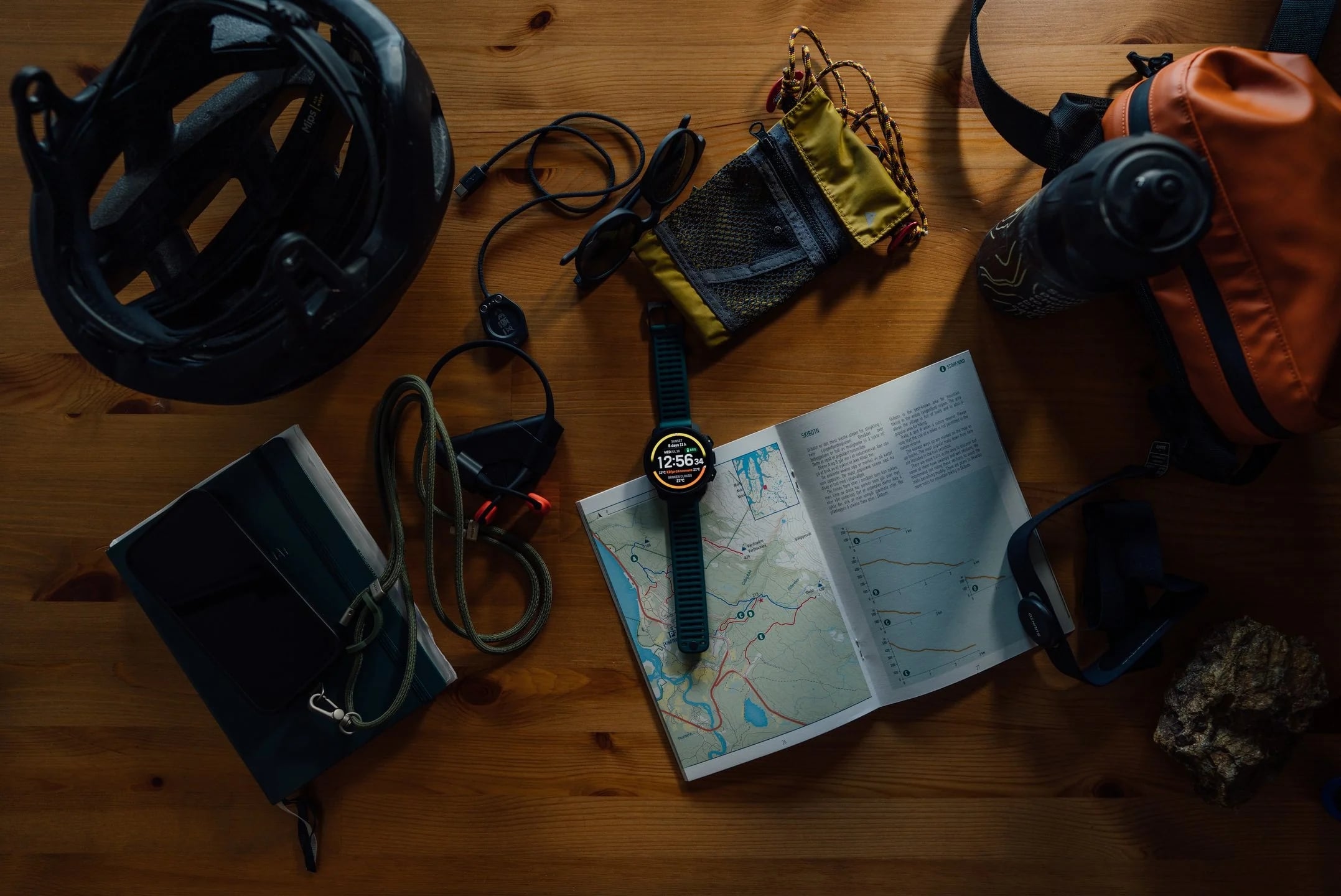
Winter conditions put more demands on your gear. When choosing outdoor equipment, look past the basics and consider how it performs in cold temperatures, changing weather and long days outdoors.
Maps and Navigation: Staying Oriented on Unfamiliar Terrain
If mobile coverage is poor, it may also be hard to use online maps to check your location and figure out which way to go.
That's where offline maps come in handy. Even without a mobile data connection, you can open a saved map to view the surrounding terrain and route information without relying on cell service.
If you've planned your hiking route in advance, you can also use GPS positioning and route navigation to check your current location and direction along the way. Comparing your position with the planned route can help you spot when you've strayed off course and adjust your direction in time.
Battery Life: Preparing for Cold and Longer Days
Cold reduces battery life, and continuous GPS tracking and navigation add to the drain. Real-world runtime often falls short of the advertised maximum, varying with GPS mode, display settings and how you use the watch.
If your watch offers several battery modes, learn how each affects positioning, navigation and battery life before you go, so you can pick the settings that match your plan.
Visibility and Usability: Reading Information in Changing Light
Bright sun on snow can wash out a screen, while cloud cover and evening light dim everything around you. A clear display with adjustable brightness makes maps and routes easier to read and the information you need quicker to find.
Touchscreens are awkward in thick winter gloves. Physical buttons let you view and switch between screens with your gloves on.
Some outdoor watches also have built-in lighting, handy after dark for finding something in your pack or checking your gear. It's a supplementary light only, and a dedicated headlamp is still essential for hiking at night.
How Suunto Vertical 2 Supports Your Winter Adventure
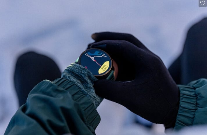
Take a winter mountain hike with some elevation gain and patchy mobile coverage as an example, and see how Suunto Vertical 2 supports you at each stage.
Before the Adventure
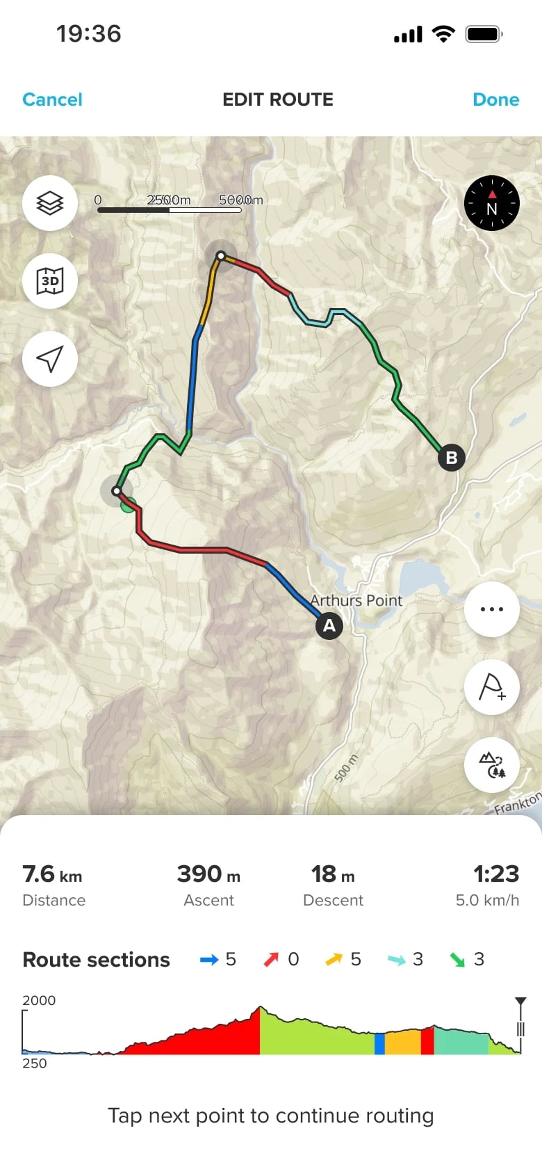
Start by creating a route in the Suunto app. The route map and elevation profile show details such as total distance and elevation gain. Explore Heatmaps to see where other users have recorded similar activities and find ideas for routes to try.
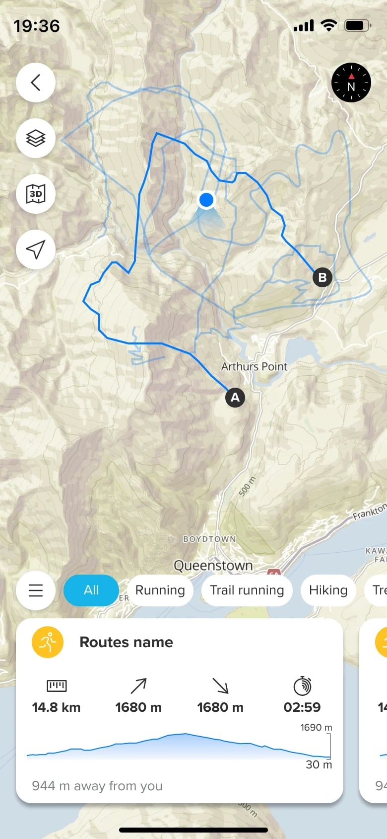
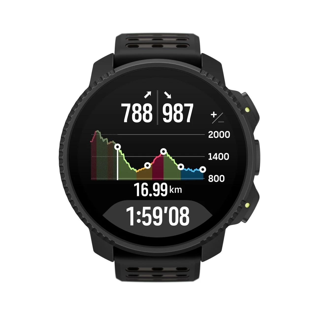
Climb Guidance lets you review the climbs and descents along your route. Using the route's elevation data, it divides the route into five section types: Flat, Uphill, Downhill, Climb and Descent, so you can understand the elevation changes ahead and plan accordingly.
You can also check local sunrise and sunset times and set alerts for them. Use these alongside the route distance, elevation and estimated hiking time to plan when to start and when to turn for home.
Once your route is ready, sync it to Suunto Vertical 2 and download offline maps for the area in advance. In the mountains, your saved maps and planned route are right there on your watch, with or without mobile data.
On the Trail: Navigate Beyond Mobile Coverage
With Suunto Vertical 2, you can view saved maps directly on your watch in the mountains, with no mobile data needed, to check the terrain and your route. Maps and GPS navigation work on the watch itself, so your phone can stay in your pack.
For positioning, Vertical 2 uses dual-band GNSS across the L1 and L5 satellite frequencies. The extra signal information supports reliable positioning in challenging outdoor environments.
Route navigation lets you follow a route you planned in advance. Once you've synced a route from the Suunto app, select it to start recording an activity, or navigate without recording.
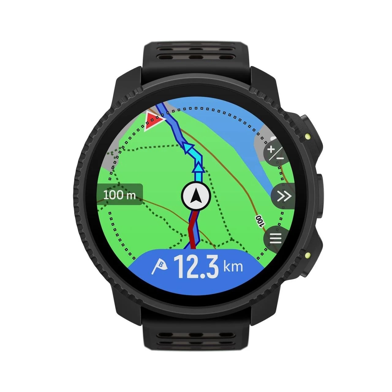
During your hike, the watch guides you along the route. If you stray more than 100 meters (about 330 feet) off course, it alerts you, and it lets you know when you're back on track. The navigation screen shows the distance to the next waypoint, or to the end of the route if you haven't set waypoints.
On routes with several climbs and descents, switch to the Climb Guidance view to see your current elevation, the elevation profile of the whole route, and how much ascent or descent you've completed and have left.
Zoom in on the current section for a closer look at its average gradient, elevation profile, remaining distance, and completed and remaining ascent or descent. With notifications on, the watch also alerts you when a climb or descent is coming up.
As Conditions Change, Stay Informed and Prepared
Battery life, screen visibility and ease of use are especially important during winter hikes. Suunto Vertical 2 offers several practical features to help you manage long days outdoors and changing light.
Weather Information
Keep an eye on the weather as you hike. The weather widget on Suunto Vertical 2 shows temperature, wind speed and wind direction, and syncing your watch with the Suunto app regularly keeps that data up to date. Storm Alarm alerts you when the watch detects a significant drop in barometric pressure, giving you another way to track changing weather.
Battery Life
Winter hikes can take longer than planned, especially when snow-covered trails or challenging terrain slow your progress. Suunto Vertical 2 offers up to 65 hours of activity recording with All-Systems GNSS and dual-frequency positioning, or up to 250 hours with power-saving GNSS settings, giving you flexibility for longer days outdoors.
Four preset battery modes—Performance, Endurance, Ultra, and Tour—let you balance runtime, positioning, and watch features to suit your hike. Along the way, you can check the estimated remaining battery life and adjust your settings to help conserve power for the rest of the journey.
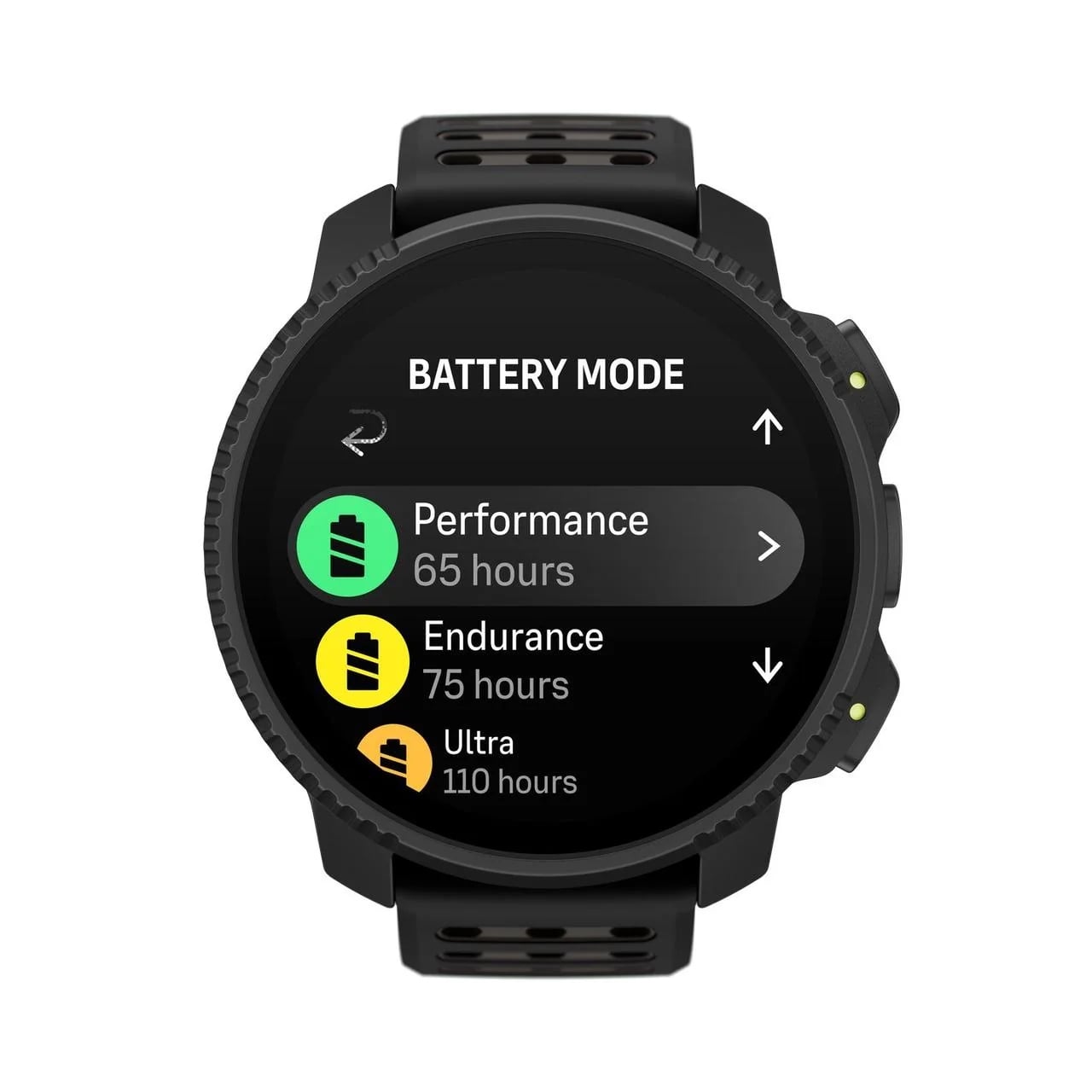
Actual battery life varies with temperature, positioning settings, display use, and other features. Cold weather can shorten runtime, while frequent map viewing adds to power consumption, so keep a margin for unexpected delays.
Display and Controls
Vertical 2 features a 1.5-inch LTPO AMOLED display with adjustable brightness, raise-to-wake and Always-On Display, so you can tune the screen to your surroundings and preferences. Keep in mind that high brightness and Always-On Display use more battery over long periods.
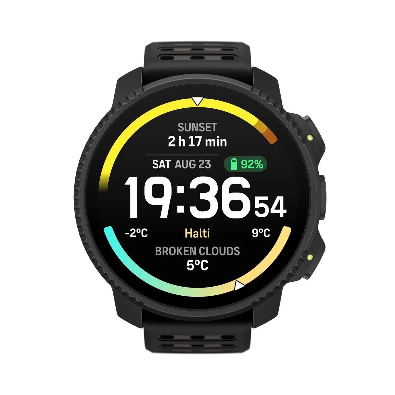
When you're wearing thick winter gloves, using a touchscreen may be less convenient than usual. Vertical 2 has three physical buttons that let you navigate screens and menus and select features. This means you can still operate the watch using the buttons when touchscreen controls aren't practical.
Built-in LED Flashlight
Vertical 2 has a built-in LED flashlight with red and white light options and three lighting modes: SOS, Breathing, and Alert. You can choose the light color and mode based on your needs, providing supplementary illumination for simple tasks in low-light conditions.
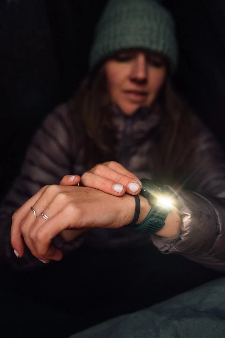
However, the watch's LED flashlight is intended for supplementary lighting only and cannot replace a dedicated headlamp for nighttime hiking. When heading into the mountains in winter, make sure you bring proper lighting equipment.
After the Adventure — Review Your Journey
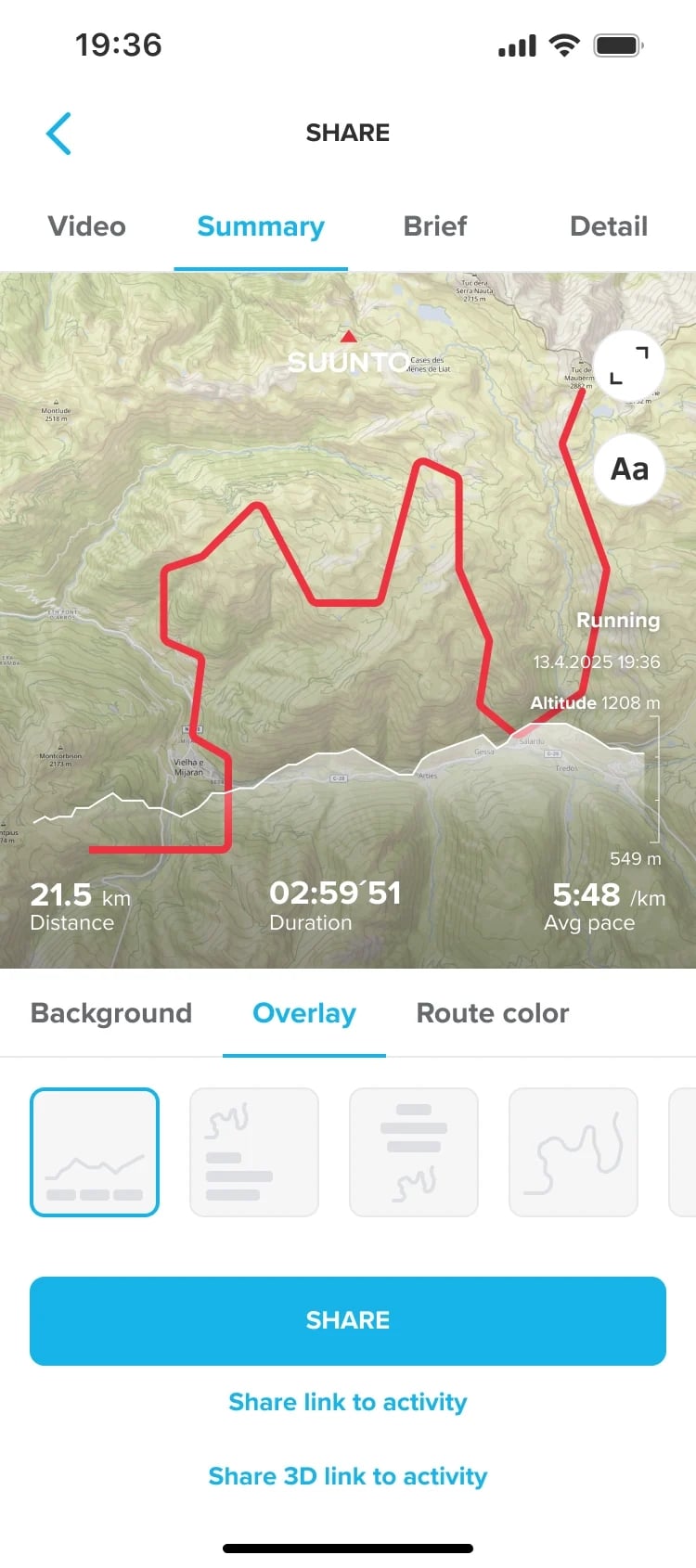
Once you've completed your hike, you can use the Suunto App to review your activity. Your activity record saves details such as the route, distance, duration, elevation changes, and total elevation gain. You can view the full GPS track to look back at the sections you covered and the climbs along the way. Reviewing these details can also help you understand your performance and prepare for your next mountain hike.
Your Final Winter Mountain Adventure Checklist
Before setting out, take a few minutes to check your route, navigation devices, and gear. The checklist below can help you make sure you haven't overlooked any important preparations.
Route & Conditions
- Check the route distance, total elevation gain, terrain difficulty, and estimated hiking time.
- Check the latest weather forecast, sunrise and sunset times, and local trail conditions.
- Identify turnaround points, backup routes, and your return plan.
- Allow extra time for possible delays.
Navigation & Electronics
- Download the offline maps you need and sync your planned route to your watch.
- Check your GPS settings, battery mode, and estimated remaining battery life.
- Fully charge your watch and other essential electronic devices.
- Bring backup navigation tools, such as a paper map and compass.
- Pack a portable power bank if needed for your hike.
Clothing & Safety
- Pack warm, windproof, and waterproof clothing suitable for the weather.
- Bring enough food and water for your planned hike.
- Carry a dedicated headlamp and spare batteries or another power source.
- Pack essential emergency supplies.
- Check whether your route and the weather conditions require specialized winter gear or outdoor skills.
- Share your route plan and expected return time with someone you trust.
A pre-hike check can help you catch anything you've overlooked, but having everything on the checklist doesn't mean conditions are suitable for every hike. If conditions aren't ideal before you set out, or the weather and trail conditions change significantly along the way, adjust your plans accordingly and turn back early if necessary.
Conclusion
Winter mountain adventures call for careful planning and preparation. Snow, ice, changing weather and shorter daylight hours can affect your route and hiking time. Checking the terrain and weather in advance and preparing reliable navigation tools can help you stay on track and adapt to changing conditions.
Suunto Vertical 2 brings offline maps, route navigation, Climb Guidance, battery management and outdoor-ready usability together in one watch, supporting you from route planning through navigation to long days in the winter mountains.
Looking for a sports watch that combines outdoor navigation, route information and the endurance for long adventures? Take a closer look at Suunto Vertical 2.